
GIS stands for Geographical Information System. It is a tool that aids in mapping and analyzing various data, such as features on the Earth’s surface. The information it gathers can be used to help businesses and governments create better decisions.
Geographical Information Systems (GIS) are software applications that collect, manage, analyze, and display geographical data. GIS are widely used in industry, government, education, and other areas.
The use of GIS has grown exponentially in recent years due to its increasing popularity in the field of urban planning. Urban planners have increasingly emphasized the importance of geographical data when building or improving cities. By looking at this data, planners can gain an understanding of the city’s future potential for growth or decline.
Importance of GIS
Geographical information systems, or GIS, can provide diverse benefits to businesses and their users. With this technology, businesses can easily identify their location and the potential that they have. The importance of GIS is not just restricted to organizations with agriculture or natural resources. For instance, companies dealing with the retail sector are using GIS. They use it to analyze data about their business locations and how they can improve them.
As a result, they are able to reduce costs and increase profits by optimizing inventory space in stores.
GIS can be used in different fields like Emergency management, public health, land management, disaster relief mitigation and response.
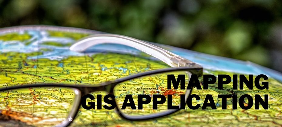
Uses and Application of GIS
GIS systems are used in several industries to help make sense of the world around them. They are also useful for mapping locations or giving presentations about data.
The use cases for GIS are expanding to include many other fields including health care and education.
We’re here to introduce you to how GIS being applied in different field. You’ll be surprised by how many different uses GIS has!
Here is the list of Applications of GIS and its uses, you may not know about.
#1. GIS in Children Education
Geography has a very important place in shaping our world, so using GIS to improve this field of study is crucial. The need for GIS Education is growing as it helps children learn and understand new concepts and gain knowledge in the field of geography.
GIS is helpful in children’s education as it allows them to visualize how cities develop and how land changes happen. It also helps them understand the relationship between human populations and environmental factors such as climate change. They can also be used for educational purposes, which would help children learn about the world they live in more effectively.
#2. GIS In Civil Engineering
Geographical Information Systems are a powerful tool to help civil engineers with the spatial aspects of their projects. For example, GIS can be used to help improve drainage patterns in cities, install underground utilities, and more.
Civil engineering has been using GIS for a variety of tasks such as managing projects and acquiring data about the state of the environment. GIS can also help civil engineers to create accurate maps and to identify different types of natural hazards.
#3. GIS In Telecommunication Services
GIS is an essential part of telecommunication services to help them plan and manage their networks.
The roles of GIS in telecommunication services include Location allocation for mobile network infrastructure, Planning the network layout and design for a fixed wireless network, Planning, deploying, and operating a fixed or mobile network with wireless access points.
#4. GIS In Urban Planning and Management
GIS is a technology that allows planners and managers to analyze, detect, and monitor changes in land features.
GIS has applications in urban planning and management. By analyzing various features of cities, GIS can help planners to make better decisions about how to manage inputs like natural resources or traffic. In addition, it can help plan for future infrastructure needs.
#5. GIS For Tourism
GIS can help with tourism promotions, better market offerings, improved customer service, a better understanding of the business performance and the location-related impacts of decisions.
Geographic Information Systems are just one of the many tools that help in tourism promotion. They provide a way to share information about destinations in order to find out what travellers are interested in visiting. This helps in promoting different places and attractions in a more efficient way.
#6. GIS In Business

GIS provides a wide range of benefits to businesses. The use cases for GIS in business are many, and the technology can provide a competitive advantage for those who know how to leverage it.
GIS became one of the most critical technologies for businesses looking for new ways to stay competitive. It is an effective way for companies to tackle challenges like customer analytics, spatial planning and disaster management more efficiently than ever before.
#7. GIS In Disaster Management
GIS has been used in disaster management to help with the mitigation of natural hazards. They are a type of technology that is used to map and analyze geographical data. GIS software is a powerful tool for disaster management organizations as it helps them identify vulnerable areas and plan effective responses.
GIS is an essential tool in disaster management. It helps with many aspects of the disaster management process, such as:
- Planning and response: GIS provides spatial data and tools that can be used to plan and execute a response to the disaster.
- Damage assessment: GIS also has been used in the post-disaster phase to map damages, which can help with recovery efforts.
- Insight into risk factors: In addition, GIS helps identify other risk factors that may have caused the disaster or made it worse.
It is evident from above how invaluable a role GIS plays in every step of the disaster management process.
The role of GIS in disaster management has been growing over the years as it has led to more efficient mitigation strategies and better planning. In addition, the use of GIS technology has helped emergency relief operations, such as Hurricane Katrina, by providing crisis teams with detailed information on the affected areas.
#8. GIS In Entertainment
GIS is slowly making its way into the entertainment industry. The implementation of maps in electronic devices has created a whole new market for mapping apps. We can now see maps on our phones and even use them to navigate.
GIS Mapping is now used by game developers, movie studios, TV studios, and other businesses in the entertainment industry. GIS technology is now widely accepted as a valid form of communication outside of the world of geography.
#9. GIS In Geography
GIS technology has been around for over 50 years. In the 1980s GIS started being used for civilian purposes like tracking agricultural growth and predicting weather patterns.
GIS is utilized in geography to produce maps and analyze spatial data. One of the most common uses of GIS is to identify environmental hazards that may affect certain areas.
GIS is used for all kinds of purposes, but some examples include looking at potential natural disasters, mapping crime statistics, finding out the best places to build a house, and even finding where there are good fishing spots available.
#10. Uses of GIS In Government
GIS can be used by government agencies for various functions. For example, GIS can be used to track natural catastrophes or help communities plan ahead for these types of events. It can also be used to map out crime patterns or identify the pollution levels in a given area.
In the future, GIS will be used by governments to make decisions more efficiently.
#11. GIS In Health & Medical Departments
GIS is a spatial analysis and data mapping program that is useful for public health practitioners. GIS can be used to map geographical areas and identify risk factors for different population groups. It can also help with the analysis of environmental factors such as air quality or weather patterns, as well as understanding health care disparities in high-risk populations.
#12. GIS In Insurance
Geographical Information Systems (GIS) has been used extensively in insurance for a long time. It is often used to analyze locations, get more competitive rates for customers, and improve the efficiency of service.
There are many uses of GIS in Insurance. One is that it can be used to analyze locations and provide customers with the best rate possible based on their location and other factors. Another use of GIS in insurance is that it can be used to improve the efficiency of services like customer service and claims processing by distributing jobs across multiple offices or departments.
They can also be used by insurance companies in order to reduce risk or just give insights into how much they should charge an individual, based on where they live.
#13. GIS In Marketing
GIS helps to find patterns, relationships, and trends in the data.
GIS can be used for various purposes in marketing because it has a variety of analytical tools that are useful for marketers. Some of these are location targeting, customer analytics, competitor analysis, parcel analysis, and demographic information.
#14. GIS In Media
GIS also has many other applications in the media industry, most notably in games.
The most popular use of GIS in media is for mapping-based games or location-based games. These are games where the player’s progress through the game world is constrained by their position on a map.
Another application of GIS is in animation and film production to track 3D camera placement and motion capture data for visual effects workflows.
#15. Uses of GIS In Meteorology & Weather Forecasting
In the field of meteorology, GIS is used for weather forecasting and tracking storms. It can be used to forecast the likelihood of a storm in a certain area by performing a wind rose analysis before it hits land.
These analyses use historical data on wind patterns to predict the direction that the storm will most likely come from and then determine what areas will be affected most severely by it.
#16. GIS In Mobile Phones and GPS Devices
Geographic information systems are becoming more common in our everyday lives, because of their ability to provide location-based services.
Mobile phones are equipped with GIS technology to make use of this functionality. This has created an entirely new market of apps that can be used for purposes such as navigation or locating specific places on a map.
#17. Application of GIS In Oil & Gas Field
GIS is a data mapping program that is mainly used in the oil and gas field. It can be utilized to map out the location of underground resources, wells, pipelines, etc.
GIS is traditionally utilized by engineers who are responsible for designing well fields. They are also used by geologists to make maps of rock layers and by geophysicists to help with drilling decisions.
GIS is used for a variety of purposes in the oil and gas industry, such as:
- Mapping and understanding the geology of an area.
- Understanding natural hazards and risks in an area.
- Creating geological models of the subsurface.
- Understanding how different structures interact with each other.
- Ensuring pipeline routes comply with environmental standards.
- Managing production from an area.
#18. Uses of GIS In Navigations
GIS is also used in navigation applications when it comes to making sure that people are able to find their way around a city or country. It can be used for any number of reasons including getting directions, locating businesses or points of interest and plotting routes.
This way it has become an important tool in any modern navigation system.
#19. GIS In Public Safety
One of the major uses of GIS is in public safety. It can be used to help in mapping out areas that are at risk for fires, floods, hurricanes, and other natural disasters. It can also be used when there are riots or protests to help with crowd control.
#20. GIS In Real Estate

GIS helps real estate professionals to better understand the locations of properties, the impact of zoning on them, and potential changes in population growth. It can be used in site selection for residential or commercial real estate investments.
GIS creates maps that are dynamic by using both spatial data and non-spatial data to show correlations between different features, which can then be analyzed by an analyst or agent.
#21. GIS In Science
GIS is also used by researchers in the natural sciences to study topics such as population ecology or to map out the locations of plants and animals.
GIS maps can be created by collecting data about where certain types of objects are located. For example, an engineer may use specialized equipment to measure water levels or rainfall intensity on a particular area of land. The measurements would then be plotted on a map using GIS software.
#22. Application of GIS In Security
Application of GIS in security is not new. There are many examples that support its application in the field of security.
GIS has been used to protect people from extreme events like natural disasters and terrorism by plotting out the risks. It has also been used to predict crime by identifying areas with high crime rates and providing information on where certain crimes are most likely to happen.
#23. GIS In Forestry
There are various applications of GIS in forestry. For example, a lot of forest areas have been mapped by using GIS that helps to understand the distribution of forest resources in a region. In addition, most forestry companies use it to help with inventorying their timber resources and also with planning for harvesting materials.
GIS in forestry can be applied to a variety of business and job functions. GIS in forestry can be used by:
- Forestry managers for spatial analysis,
- Land management staff for forest inventory and wildlife habitat mapping,
- Private consultants for land stewardship,
- Forestry technicians for tree inventories and species distribution mapping,
- Foresters for fire protection and long-term forest management planning.
#24. Application of GIS In Landuse
Land use mapping mainly includes the three broad categories: agricultural land uses, residential land uses and commercial/industrial land uses. A GIS can be used to map these types of land use by overlaying them on the base map.
#25. GIS For Water Management
GIS can be used to track and organize water-related information.
Water is a resource that every country needs to manage effectively in order to guarantee sustainable growth and protection of the environment. GIS is a tool for mapping, monitoring, and managing water resources at the global scale.
#26. GIS Application In Agriculture
Geographic Information System (GIS) is used in all aspects of agriculture today. From agricultural planning to irrigation techniques, GIS is playing an increasingly important role in the field.
GIS helps with crop yield maximization by optimizing planting patterns, optimizing irrigation schedules, and helping farmers predict market prices. Some GIS analysis is also being applied to the use of pest-resistant crops and their effect on land conservation.
It is used to provide product and commodity traceability by tracking crops from harvest to market.
#27. GIS In Geology
In geology, GIS allows us to map out natural resources and wastebunkering deposits. It can help with understanding the relationship between a specific type of rock and oil or metal deposits.
It is used to analyze and visualize spatial data for a wide range of applications, from studying the earth’s surface, to modeling natural resources, mapping environmental change or disease outbreaks.This visualization platform has been an essential tool for cartographers and geologists.
#28. GIS In Asset Management
In the process of asset management, GIS can be used for different purposes. It can help identify potential risks and find the optimal time to repair assets. In addition, GIS is also applied in construction planning and engineering design, site development planning and management, environmental assessment, forest protection and restoration monitoring.
GIS is an indispensable tool for asset managers in today’s competitive world.
#29. Application of GIS In Mapping
With the advancement in technology and increase in computing power, geospatial technologies have become more widespread these days. It is now easier than ever before to create your own custom map with all kinds of features like routing through GPS coordinates or street view with 3D buildings.
It’s not only about creating maps; Geographical Information Systems can also be used for tracking agricultural yields or predicting natural disasters.
#30. Use of GIS For Transportation
GIS is used in multiple fields including transportation, one of the most important fields. With the advancement in technology, now GIS can be implemented to do complex analyses and help make better decisions. GIS allows planners to analyze data, predict future outcomes, and develop new transportation plans faster than ever before.
When it comes to planning for a city’s public transit system, GIS is essential for planning routes that connect people with different modes of transportation including walking, biking, driving, and transit.
#31. GIS In Military
Map-making is an important military application of GIS. The maps are used for both operational and tactical purposes, such as
- Positioning of ground troops
- Coordinating fire support
- Airborne operations.
GIS is used in the military, which can be used to plan troop movements and for directing artillery fire.
#32. GIS For Police Departments
GIS is used by the police department to create maps of crime, locate addresses and draw boundaries that identify where crimes are most likely to occur. GIS also helps the police to analyze crime patterns such as when and where a particular type of crime occurs.
The software can be used in investigations by helping criminal investigators with their work. The investigators can use GIS for analyzing geographic data and identifying patterns in the data so that they can find out what is going on and who might be behind it.
#33. GIS For Fire Departments
GIS has been applied in many fields and is now being used by fire departments as a tool for intelligence and efficiency.
GIS can be used to identify the distances and locations of fire hydrants, water hazards, construction sites, and other important information that can help firefighters on their way to a call. This helps with response time as well as helping the firefighters know what they’re up against before they arrive on site.
#34. GIS For Emergency Services

GIS is a system that allows emergency services personnel to analyze a large geographic area and provide relief in a timely manner. With the help of GIS data, emergency responders can identify the best route for their vehicles and locate potential hazards. In order to improve response times and efficiency to emergencies, emergency services agencies need accurate GIS data.
Conclusion
In this article, we explore the different ways geospatial technology can offer competitive advantages for firms. We outline these advantages and provide examples of how they are being used today.
The application of GIS has increased over the years. The reason is the advancements in technology which have allowed people to do more with the tool.
The different uses of GIS are evident by looking at its applications in different industries. Along with this, it also has academic uses such as teaching students about geography and exploring their geographical surroundings.
