
If you’re someone who loves to travel, explore new places, or even just navigate your own city, then knowing how to read a map is an essential skill. While digital maps and GPS technology have made navigation more accessible, there’s something to be said about the importance of understanding traditional paper maps.
In this article, we’ll take you through the basics of how to read a map. From understanding the different types of maps to interpreting symbols and landmarks, you’ll gain the knowledge and confidence to navigate your way through any map-based challenge.
To read a map, start with an overview map and move toward detail. If you’re reading a road map, for example, start at the larger scale, like state or country, and work your way down to the smallest scale, like city or town. If you’re reading a map with terrain or topographic features, make sure to use an aerial view as a reference point. Then, use a street map as a visual aid.
Why Learning How To Read A Map Is Important?
While GPS and digital maps have made navigation a breeze, knowing how to read a traditional map is still an important skill. Not only can it help you navigate areas with little or no digital connectivity, but it can also improve your spatial awareness and understanding of the world around you.
Learning how to read maps can also be an enjoyable and rewarding experience. It can help you discover new routes, hidden gems, and fascinating geographical features that you might otherwise have missed.
Types of Maps
There are many different types of maps, each designed for a specific purpose. Some of the most common types of maps include:
- Topographic Maps: These maps use contour lines to show the elevation and terrain of an area. They’re often used by hikers, mountaineers, and other outdoor enthusiasts.
- Political Maps: These maps show political boundaries such as countries, states, and cities.
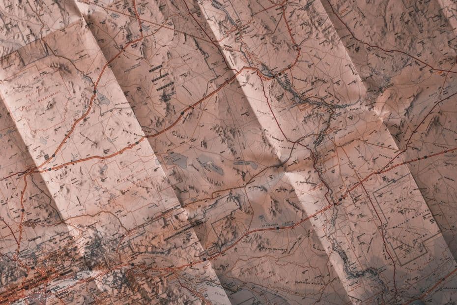
- Road Maps: These maps show roads, highways, and major landmarks such as cities and towns.
- Weather Maps: These maps show weather patterns and conditions such as temperature, precipitation, and wind.
- Nautical Charts: These maps are used by sailors and boaters to navigate bodies of water and show important features such as depths, rocks, and reefs.
READ MORE: How Do You Read A Topographic Map?
Understanding Scale
One of the most important aspects of a map is its scale.
Scale refers to the relationship between the distance on the map and the actual distance on the ground. For example, a map with a scale of 1:10,000 means that one inch on the map represents 10,000 inches (or 833 feet) on the ground.
Understanding scale is crucial for accurate navigation and measuring distances on a map. It’s important to note that different maps may have different scales, so always check the scale bar on the map to ensure accurate measurement.
Symbols and Landmarks
Maps are full of symbols and landmarks that can help you navigate and identify different features of an area. Some common symbols you might find on a map include:
- Roads: Different types of roads are often indicated by different colors or line styles.
- Bodies of Water: Rivers, lakes, and oceans are often indicated by different shades of blue.
- Landmarks: Important landmarks such as monuments, buildings, and parks are often indicated by symbols or icons.
- Contour Lines: These lines indicate changes in elevation and help show the shape of the land.
Understanding these symbols and landmarks can help you navigate and identify different features of a map with ease.
Topography and Contour Lines
Topographic maps are an important tool for outdoor enthusiasts, as they show the elevation and terrain of an area. These maps use contour lines to represent the shape of the land. Contour lines connect points of equal elevation, and by reading these lines, you can determine the steepness of slopes, the presence of hills or valleys, and other features of the terrain.
When reading contour lines, keep in mind that:
- The closer the contour lines are to each other, the steeper the slope.
- Contour lines that are close together or touching indicate a steep slope or cliff.
- Contour lines that are far apart indicate a gentle slope or flat terrain.
Understanding how to read contour lines can help you plan your route and avoid difficult or dangerous terrain.
READ MORE: What Are Contour Lines and Why Are They Important?
Reading Grids and Coordinates
Many maps are divided into grids and use coordinates to identify specific locations. A grid is a pattern of vertical and horizontal lines that divide a map into sections, while coordinates are a set of numbers or letters that correspond to specific points on the map.
To read grids and coordinates:
- Locate the coordinates for your current location or destination.
- Find the corresponding grid on the map.
- Use the grid lines to navigate to your destination.
Using grids and coordinates can help you navigate with precision and accuracy, even in unfamiliar territory.
Navigating with a Compass
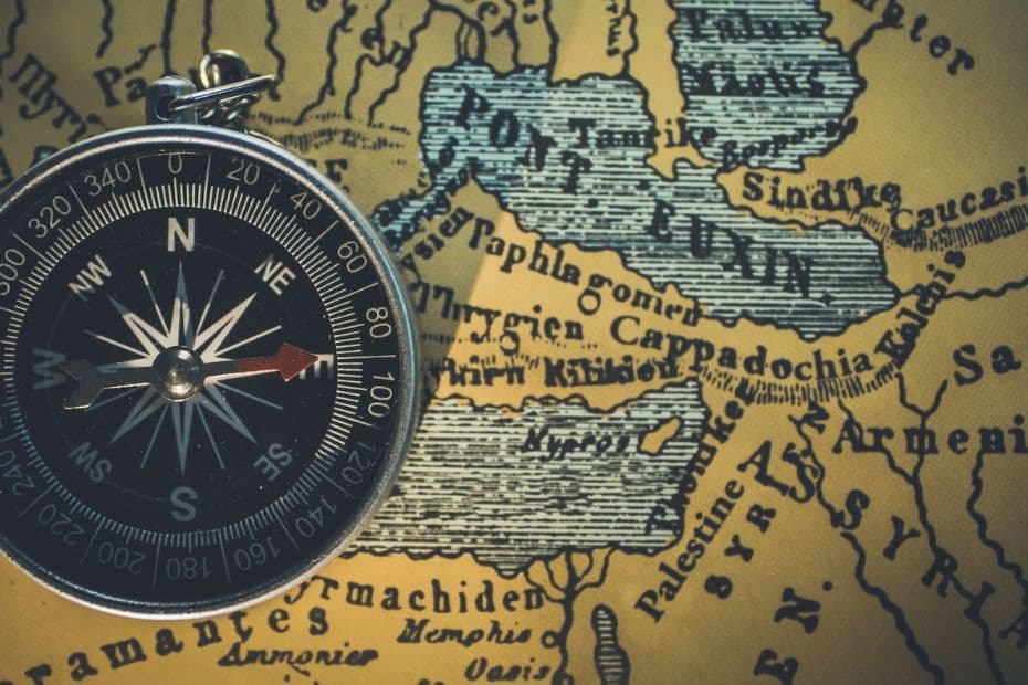
While GPS devices and digital maps have largely replaced compasses, understanding how to navigate with a compass is still an important skill. A compass uses a magnetized needle to indicate north, which can help you determine your direction of travel and navigate through unfamiliar terrain.
To use a compass:
- Hold the compass level and steady.
- Turn the compass until the needle aligns with the north marker on the compass.
- Follow the direction indicated by the compass needle.
Using a compass can help you navigate through areas with little or no digital connectivity, and can also be a fun and challenging way to explore the outdoors.
READ MORE: True North Vs Magnetic North?
Using Map Legend and Key
Many maps include a legend or key that explains the symbols and abbreviations used on the map. Understanding the legend or key can help you identify important features and navigate with ease.
To use a map legend or key:
- Locate the legend or key on the map.
- Refer to the legend or key to identify different symbols or abbreviations.
Using the legend or key can help you navigate and understand the features of a map more effectively.
Interpreting Aerial Photographs
Aerial photographs provide a unique perspective on an area and can be useful for identifying features that may not be visible on a traditional map. Aerial photographs are often used by surveyors, geologists, and other professionals to gather information about an area.
To interpret aerial photographs:
- Look for patterns and features such as roads, buildings, and bodies of water.
- Use the scale bar to determine the size of features on the photograph.
- Compare the aerial photograph to a traditional map to identify landmarks and features.
Interpreting aerial photographs can provide valuable information about an area and help you navigate with greater precision.
READ MORE: Aerial Photography and Remote Sensing
Map Projections and Distortion
Map projections refer to the process of representing a three-dimensional surface (such as the Earth) on a two-dimensional map. Because the Earth is round and a map is flat, map projections inevitably lead to some distortion or inaccuracy in the representation of features.
Understanding map projections and distortion is important for interpreting maps accurately and avoiding navigational errors.
READ MORE: Best Map Projection
Map Orientation
Map orientation refers to the position of a map relative to the cardinal directions (north, south, east, and west). Understanding map orientation is important for accurate navigation and interpreting the features of a map.
READ MORE: North Arrow On A Map
Digital Maps vs Paper Maps
Digital maps and paper maps each have their own advantages and disadvantages. While electronic maps offer greater convenience and accessibility, paper maps can provide a more tactile and immersive experience.
Tips For Reading Maps Like a Pro
To read maps like a pro, follow these tips:
- Practice regularly: Reading maps is a skill that takes practice. The more you use maps, the better you will become at interpreting them.
- Start with simple maps: Begin with simple maps and gradually work your way up to more complex ones. This will help you build your skills and confidence.
- Use a magnifying glass: A magnifying glass can be a helpful tool for reading small print and details on a map.
- Pay attention to symbols and labels: Symbols and labels on a map can provide important information about features such as roads, rivers, and landmarks.
- Look for patterns: Patterns such as contour lines, grids, and geographic features can provide important clues about the terrain and how to navigate it.
- Take notes: Jotting down notes about your route, landmarks, and other features can help you stay on track and avoid getting lost.
- Use multiple sources: Consult multiple maps and sources to get a more comprehensive understanding of the area you are exploring.
By following these tips and practicing regularly, you can become a skilled map reader and navigate through unfamiliar terrain with confidence.
Conclusion
Reading maps is an important skill that can help you navigate through unfamiliar terrain, plan your route, and avoid dangerous or difficult terrain. By understanding the basics of map reading, including reading contour lines, using grids and coordinates, navigating with a compass, and interpreting map legends and keys, you can become a skilled map reader and explore the outdoors with confidence.
FAQs: How To Read A Map?
Why is it important to learn how to read maps?
Learning how to read maps is important for navigating through unfamiliar terrain, planning your route, and avoiding dangerous or difficult terrain.
What are some common symbols found on maps?
Common symbols found on maps include roads, rivers, mountains, and landmarks.
Can electronic maps replace paper maps?
Electronic maps offer greater convenience and accessibility, but paper maps can provide a more tactile and immersive experience.
What are some tips for reading maps like a pro?
Some tips for reading maps like a pro include practicing regularly, starting with simple maps, using a magnifying glass, and paying attention to symbols and labels.
How can map projections and distortion affect map interpretation?
Map projections and distortion can lead to inaccuracies in the representation of features on a map, which can affect map interpretation and lead to navigational errors.
