
This article will explore the differences in map projections, Best Map Projections and how they impact maps in various ways.
A map projection is a way of representing the Earth’s surface that simplifies and projects the spherical form onto a two-dimensional surface.
What is a Map Projection?
Map projections are a way of representing the earth’s round surface onto flat surfaces.
In cartography, map projection refers to a particular way of representing the round Earth onto a flattened map. It is a way to reduce distance and scale so that the Earth’s surface can be shown on a flat surface.
Before we go on to the explanation of map projections, we need to first understand the purpose of map projection. This will help us understand why we use the projection that we use on a given map.
There are mainly two purposes of map projections:
- To show the whole Earth on a flat surface.
- To show a part of Earth and its surrounding area and make it easier for people on Earth to find their location or point on this flattened out the surface.
There are many map projections in use, each presenting certain advantages and disadvantages.
What Are The Best Map Projections?
For a world map, a flat map is accurate when it comes to scale and shape. However, when you want to represent the Earth in two dimensions, there are many different options.
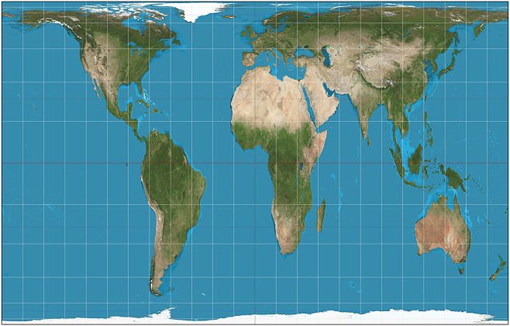
#1. Mercator
The most popular projection is the Mercator projection. The Mercator projection was created in 1569 by Gerardus Mercator for navigational purposes and became popular because it shows relative sizes accurately and is useful for navigation. The idea behind it is that straight lines drawn on this map are equivalent to great circles of longitude on Earth. And that lines of latitude are drawn as perpendiculars to these lines.
Best Used in the area near the Equator and for Marine Navigation.
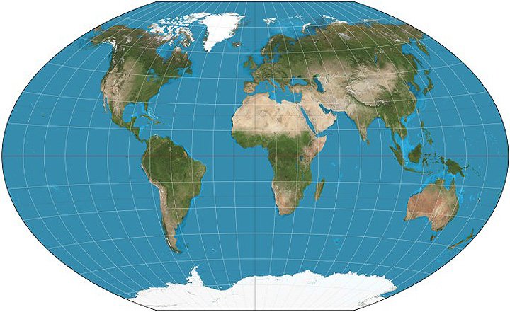
#2. Robinson
The Robinson projection is a map projection of the earth’s surface onto an imaginary sphere. It was created by Arthur Robinson in 1963. The Robinson projection is often used for world maps in school textbooks because it reduces to a rectangle and so can be easily printed on one page. This makes it popular in educational materials but also limits its usage for other purposes.
Best Used in the area around the Equator.
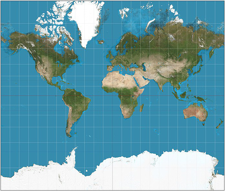
#3. Gall-Peters
Gall-Peters projection is a cylindrical world map projection and was proposed by James Gall and Arno Peters. Gall described this projection in 1855 and in 1973 Peter began to heavily use this projection. It shows the correct sizes of countries relative to each other. It stretches the area vertically near the equator. This projection is promoted by UNESCO and widely used in British Schools.
If you wanted to show both the size and shape of countries on a world map, then the Gall-Peters projection is most accurate.
Best Used in to show equal area.
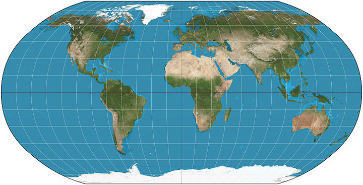
#4. Winkel-Tripel
The Winkel-Tripel map projection is a modified azimuthal projection. It was developed by Oswald Winkel in 1921. The goal is to minimize the three types of distortion i.e: Area, Distance and Directions.
Best Used for World Maps and General Purpose Maps.
#5. AuthaGraph
The AuthaGraph Map projection is a type of map projection developed by dividing the spherical surface of the map into 96 triangles. It is Invented in 1999 by Japanese architect Hajime Narukawa. It is significantly more accurate than traditional 2-D maps and can be folded into a 3D Globe.
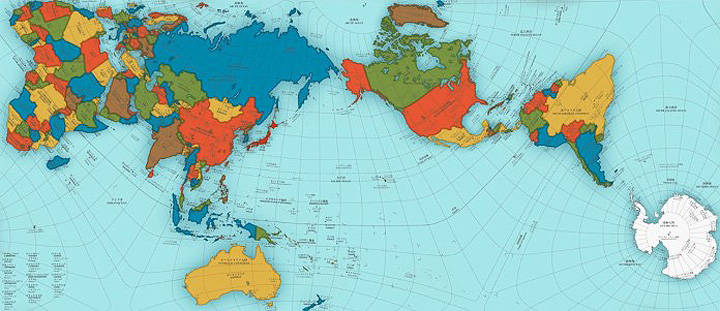
Best Used to retain correct proportional sizes of the continents and oceans & even Antarctica.
How Do Map Projections Change the Way We See the World?
A map projection is the representation of the earth’s surface on a flat surface such as a map. There are different types of map projections, each one serving its own purpose and good at representing certain features of the earth’s surface or for specific uses.
Conclusion:
Maps are a way for people to understand the world and what they see in it. With so much happening in this era, we need to see the world from many different perspectives if we want to get the most out of our maps.
Maps can be used for many different purposes, such as analyzing weather patterns or understanding topography. Different projections can help map designers take into account what they want the reader to know about when viewing their map.
FAQ: About Best Map Projections
Best map projection for a small area?
AuthaGraph
Most accurate map projection?
Winkel Tripel