
The components of GIS are the building blocks that make up the system. This article will explore the various components of GIS, their functions, and how they work together to provide valuable insights into spatial data.
The core components of GIS, are hardware, software, data, people and method.
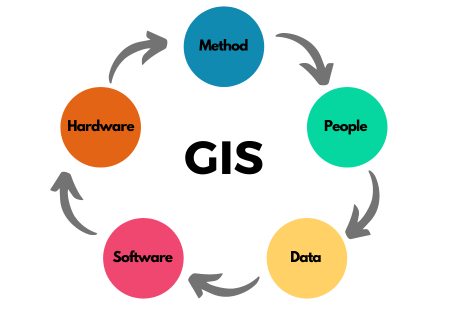
5 Components of GIS
The components of GIS work together to provide a powerful and comprehensive tool for managing and utilizing geographic data. Here are the main components of GIS:
1. Hardware
The hardware component of GIS refers to the physical tools and equipment necessary to collect, store, and process geographic data. These tools include computers, servers, GPS devices, scanners, printers, and other peripherals. GIS hardware should be able to handle large amounts of data and run software applications without any lag. Some essential hardware components of GIS include:
GPS Devices
Global Positioning System (GPS) devices are essential hardware components of GIS that enable the collection of spatial data with high accuracy. GPS devices can determine the location of an object or point in space, making them critical for mapping and geolocation applications.
Scanners
Scanners are used to convert paper maps, drawings, and other hard-copy materials into digital formats that can be stored and analyzed in GIS software. Scanners are essential for converting legacy data into a digital format.
Computer Systems
GIS software requires robust computer systems to run effectively. The hardware components of these systems include processors, RAM, hard drives, and graphics cards, among others. The system should be powerful enough to handle large datasets and run complex GIS software applications.
2. Software
GIS software is a suite of computer applications used to manage, manipulate, analyze, and visualize geographic data. These applications enable users to perform spatial analysis, create maps, and perform other GIS-related tasks. Some essential software components of GIS include:
Desktop GIS Software
Desktop GIS software is installed on a computer and used for mapping, data analysis, and data management. This software includes tools for creating and editing maps, querying data, and analyzing spatial relationships. Some popular desktop GIS software includes ArcGIS, QGIS, and GRASS GIS.
Web GIS Software
Web GIS software is accessed through a web browser and is used to share, collaborate, and publish geographic data over the internet. This software enables users to create interactive maps and perform spatial analysis. Some popular web GIS software includes ArcGIS Online, Google Maps, Openstreetmap and OpenLayers.
3. Data
GIS data refers to the geographic information used in GIS software applications. This data can be divided into two main categories: spatial data and non-spatial data (attribute data). Spatial data refers to the geographic features and locations that are represented on a map, while attribute data refers to the non-spatial information associated with those features. Some essential data components of GIS include:
Spatial Data
Spatial data refers to the geographic features and locations that are represented on a map. This data can include information about the physical characteristics of an area, such as elevation, terrain, and land use.
Attribute Data
Attribute data refers to the non-spatial information associated with geographic features. This data can include information such as population demographics, infrastructure data, and other data points that are not represented on a map.
4. People
People are the most critical component of GIS. Without skilled personnel to collect, manage, and analyze geographic data, GIS would be ineffective. The people component of GIS refers to the personnel involved in designing, developing, and implementing GIS projects. Some essential people components of GIS include:
GIS Analysts
GIS analysts are responsible for designing, developing, and implementing GIS projects. They are responsible for analyzing spatial data, creating maps, and performing spatial analysis.
GIS Technicians
GIS technicians are responsible for collecting, organizing, and managing GIS data. They ensure that data is accurate, up-to-date, and easily accessible to GIS analysts.
GIS Managers
GIS managers oversee the implementation of GIS projects and ensure that projects meet organizational goals and objectives. They are responsible for managing GIS personnel, budgets, and resources.
5. Methods
The methods component of GIS refers to the various analytical and processing techniques used to interpret and manipulate geographic data. This component is vital in ensuring that GIS is able to provide useful insights and solutions.
Some of the methods used in GIS include:
Geocoding
Geocoding is the process of assigning geographic coordinates to non-spatial data, such as addresses or place names. This process allows the data to be plotted on a map and used for spatial analysis.
Spatial Analysis
Spatial analysis involves the examination and manipulation of geographic data to identify patterns, relationships, and trends. Spatial analysis techniques include spatial statistics, network analysis, and terrain analysis.
Remote Sensing
Remote sensing involves the use of sensors, such as satellites or drones, to collect data about the Earth’s surface. This data can be used to create detailed maps and to monitor changes in the environment over time.
Cartography
Cartography is the art and science of map-making. Cartographers use GIS software to create and design maps that are accurate, informative, and visually appealing.
Data Visualization
Data visualization involves the use of charts, graphs, and other visual aids to present geographic data in a clear and understandable way. This technique is used to communicate complex information to non-technical audiences.
How The GIS Components Work Together?
The components of GIS work together to provide a powerful platform for spatial data management, analysis, and visualization. The workflow of a GIS system involves the following steps:
Data Acquisition
The first step in GIS is data acquisition. Spatial data can be acquired from various sources such as GPS devices, satellite imagery, and surveys.
Data Entry
Data entry involves capturing the acquired data into the GIS system. This can be done using input devices such as digitizers or by importing data from other sources.
Data Management
Data management involves storing, organizing, and retrieving spatial data. This is done using a DBMS that enables efficient storage and retrieval of data.
Data Analysis
Data analysis involves applying statistical and spatial analysis tools to the data. This enables users to identify patterns, trends, and relationships in the data.
Data Visualization
Data visualization involves displaying and presenting the analyzed data in a visual format. This can be done using maps, charts, and graphs.
Importance of GIS Components In Mapping
GIS components play a crucial role in mapping by allowing us to gather, analyze, and visualize spatial data from various sources.
With the help of geospatial technology, location-based analysis, cartography, and remote sensing, we can create and update accurate and informative maps that help us better understand the world around us.
These maps help us identify patterns and trends over time, making it easier to make informed decisions about issues related to urban planning, transportation, natural resource management, and more.
The importance of GIS components in mapping lies in their ability to provide us with a comprehensive understanding of the world around us.
By analyzing data based on its location, we can gain valuable insights into how different factors are related to one another, and make more informed decisions about how to manage our communities.
Whether it’s identifying areas that are at risk of flooding, analyzing the risk of landslides or earthquakes, or monitoring changes in vegetation over time, GIS components help us visualize complex data and understand how it relates to the real world. Ultimately, the use of GIS components in mapping can lead to more efficient and effective decision-making, which benefits everyone.
Conclusion
GIS is a powerful tool used to manage, analyze, and visualize spatial data. The components of GIS are the building blocks that make up the system. They include computer hardware, input devices, output devices, GIS software, DBMS, remote sensing software, and spatial analysis software. These components work together to provide a powerful platform for spatial data management, analysis, and visualization.
FAQs:
What are the examples of hardware components of GIS?
Examples of hardware components of GIS include GPS receivers, computer systems, printers, plotters, scanners, digitizers, and tablets. These hardware components are used to collect, store, and analyze spatial data.
What are the 5 main components of GIS?
The five main components of GIS are hardware, software, data, people, and methods.
What are the three major data types in GIS?
The three major data types in GIS are raster data, vector data, and metadata. Raster data is represented by a grid of pixels and is used to represent continuous data, such as elevation. Vector data is represented by points, lines, and polygons and is used to represent discrete data, such as land use. Meta data refers to the data about data.
What are the functions of GIS?
The functions of GIS include data capture, data storage, data manipulation, data analysis, and data visualization.
