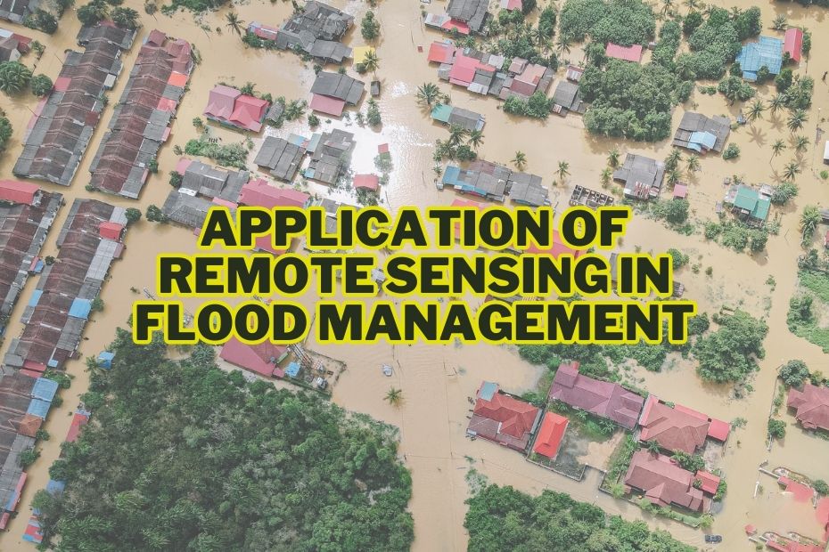
Floods pose significant threats to lives, infrastructure, and the environment. Rapid advancements in technology have led to the application of remote sensing techniques in various fields, including flood management. In this article, we will explore application of remote sensing in flood management, highlighting its importance in minimizing the impact of floods.
Remote Sensing enables real-time data collection on flood extent and severity, identifying areas at risk, and evaluating damages post-flood.
Application of Remote Sensing In Flood Management
Through the application of remote sensing, flood-prone areas can be better prepared, and lives and infrastructure can be protected from the devastating impacts of floods. Here are some of the application of remote sensing in flood management:
1. Flood Mapping and Monitoring
Accurate flood mapping and real-time monitoring are crucial for effective flood management. Remote sensing platforms such as satellites, aerial imagery, and unmanned aerial vehicles (UAVs) enable the collection of high-resolution data over large areas. This data is used to create flood maps that depict the extent and severity of flooding. Through remote sensing, stakeholders can identify vulnerable areas, track flood progression, and assess the magnitude of the disaster. These maps serve as a valuable resource for emergency response planning, evacuation strategies, and resource allocation.
2. Early Warning Systems
With the help of remote sensing, advanced early warning systems can be developed to alert communities about impending floods. By analyzing precipitation patterns, river levels, and soil moisture content, remote sensing technologies can provide valuable data for flood forecasting models. These models can predict flood events, allowing authorities to issue warnings, evacuate vulnerable areas, and mobilize resources for disaster response in a timely manner.
3. Flood Damage Assessment
After a flood event, assessing the extent of damage is crucial for effective response and recovery efforts. Remote sensing techniques enable rapid and comprehensive damage assessment. High-resolution satellite imagery and aerial surveys provide detailed information about infrastructure damage, changes in land cover, and the impact on ecosystems. Through remote sensing analysis, authorities can prioritize relief efforts, estimate economic losses, and plan for reconstruction and rehabilitation.
4. Watershed Management
Watershed management plays a vital role in flood prevention and mitigation. Remote sensing aids in the assessment and monitoring of watersheds, enabling effective land and water resource management. Satellite imagery and digital elevation models help identify potential sources of runoff, erosion, and sedimentation. By analyzing land cover changes, vegetation indices, and hydrological parameters, stakeholders can implement targeted strategies for watershed protection, including reforestation, erosion control measures, and the construction of retention ponds.
5. Rainfall Estimation and Prediction
Accurate estimation and prediction of rainfall are essential for flood forecasting. Remote sensing technologies provide valuable insights into precipitation patterns by analyzing cloud cover, atmospheric conditions, and temperature gradients. This data helps meteorologists and hydrologists improve rainfall prediction models, enhancing the accuracy of flood forecasts and enabling better preparation and response to potential flood events.
6. River and Stream Monitoring
Monitoring the flow and behavior of rivers and streams is essential in flood management. Remote sensing platforms offer valuable tools for monitoring water levels, flow rates, and sediment transport. Satellite altimetry and radar sensors provide continuous monitoring of river height changes, enabling the detection of floods and the assessment of river dynamics. This information aids in flood forecasting, infrastructure planning, and the identification of flood-prone areas.
7. Urban Planning and Infrastructure Development
Remote sensing supports urban planning and infrastructure development with flood resilience in mind. High-resolution satellite imagery helps identify flood-prone areas, assess urban expansion, and determine suitable locations for infrastructure projects. By integrating remote sensing data with Geographic Information Systems (GIS), planners can make informed decisions regarding land use, drainage systems, and the design of flood-resistant infrastructure. This proactive approach ensures that cities and communities are better prepared to withstand flood events.
8. Climate Change Impact Assessment
The effects of climate change, including increased frequency and intensity of rainfall, have significant implications for flood management. Remote sensing provides a valuable tool for assessing climate change impacts on flooding. By analyzing long-term satellite records, researchers can identify trends in precipitation patterns, monitor changes in land cover, and understand the interactions between climate, hydrology, and flooding. This knowledge contributes to the development of adaptation strategies and informs policymakers and stakeholders about the potential future risks associated with climate change-induced floods.
9. International Collaboration and Data Sharing
Remote sensing promotes international collaboration in flood management. Through the sharing of satellite data, expertise, and best practices, countries can work together to improve flood monitoring and response capabilities. Remote sensing platforms, such as NASA’s Global Precipitation Measurement (GPM) mission, facilitate global data exchange, enabling a more comprehensive and coordinated approach to flood management on a regional and global scale.
Conclusion
The application of remote sensing in flood management has revolutionized our ability to prevent, prepare for, and respond to floods. From flood mapping and monitoring to early warning systems and damage assessment, remote sensing technologies offer valuable insights and tools for effective flood management strategies. By harnessing the power of remote sensing, policymakers, scientists, and communities can work together to minimize the impacts of floods, protect lives and property, and build resilient societies in the face of increasing flood risks.
FAQs: Application of Remote Sensing In Flood Management
How does remote sensing help in flood mapping?
Remote sensing enables the creation of accurate flood maps by utilizing satellite imagery to identify and monitor flooded areas. This information assists authorities in understanding the extent of the flooding and planning appropriate response measures.
Can remote sensing predict floods?
By analyzing factors such as precipitation, river levels, and soil moisture, remote sensing technologies contribute to more accurate flood predictions and early warning systems.
How is remote sensing used in flood damage assessment?
Remote sensing techniques, such as high-resolution satellite imagery, aid in rapid damage assessment after a flood event. These methods provide detailed information about infrastructure damage, land cover changes, and soil erosion, assisting in evaluating the extent of the impact and facilitating efficient resource allocation for recovery efforts.
