
Karst topography is a word that describes the land that has been created by water dissolving away the limestone of the earth. Karsts are found throughout the world but are most predominant in areas where there is little precipitation.
These underground formations are important because they may create habitats for plants and animals in otherwise inhospitable areas where the surface bedrock would not support life. So, Let’s discuss in detail about: What Is Karst Topography and How It Forms?
What Is Karst Topography?
Karst topography is defined by sinkholes, caves, and other geological features called karst. These are formed when water dissolves the bedrock under it. Karst is most prominent in areas with limestones or carbonates because these are the rocks that are soluble in water.
One example of karst topography is Mammoth Cave in central Kentucky.
The original term “karst” derives from the word chalk that describes the substance that was left behind in the limestone after it eroded over time creating depressions. Mountain springs are also a characteristic of karst topography.
This is a slow process and can take anywhere from 10,000-100,000 years to create a fully developed karst formation. These regions with karstic formations can be home to many diverse species of plants and animals.
Why Does Karst Topography Exist?
Karst topography is a surface property that occurs in places where groundwater has dissolved a significant amount of soluble bedrock. The features of the karst topography are typically sinkholes, disappearing streams, caves, and rugged terrain.
The process of karstification is the result of the release of natural chemical components from limestone and dolomite rock.
How Karst Topography Form?
Karst topography is formed when water dissolves the bedrocks. After water penetrates the soil and dissolves carbon dioxide from the atmosphere, it forms carbonic acid that decalcifies bedrock and leads to the formation of these features.
It has been seen in some places that streams can dissolve limestone away, while in other areas it may be due to rainwater.
What Are The Features of Karst Topography?
Karst topography is a type of relief that occurs when limestones are dissolved. This means that the surface has many caves, sinkholes, and underground streams. Karst topography has different shapes and sizes depending on the type of rock they are made out of.
Karst topography is a type of geography that has been formed by the dissolution of the bedrock. Karsts are usually characterized by vertically exposed limestone, which is often riddled with caves. Karst topography can be found in many parts of the world, including Europe, China, and the southwestern United States.
Karst landforms are areas that are characterized by underground cavities and where water can be found. Despite their fragile appearance, these features are often quite stable because they form in relatively clay-free limestone. Various characteristics of karst landforms include sinkholes, caves, disappearing streams, abundant springs, and rapid sinking of the ground surface.
What Is A Sinkhole?
For most people, a sinkhole is a large hole or depression in the ground with an opening at the top. They are often caused by acidic rain and may be filled with water, sand, dirt, and debris.
A sinkhole is an area of ground that opens up as if a bowl has been punched from beneath the earth’s surface into the land above. Sinkholes can vary in size from a few feet across to hundreds of acres. Their origins lie deep below the earth’s surface and the openings can reach several stories above the surface.
Some have remained open for thousands of years while others appear overnight and disappear just as quickly.
Effects of Karst Topography
Karst topography can affect the lives of people living nearby it because it can be unstable. It can lead to landslides or sinkholes which causes property damage for those living nearby because the ground will drop away from their house.
This also causes problems with water because water goes underground which makes it harder to find sources of drinking water for humans.
Karsts themselves don’t directly affect plant life, but they do play a role in how water flows through the landscape. In some cases, the karsts that form as a result of groundwater can lead to an increase in plant life because there is more water available for plants to use.
Karst regions are often described as being riddled with caverns and riddled with sinkholes that can lead to severe flooding in the event of rainfall or subsidence.
Types of Karst Topography
Karst topography is a special form of terrain found in areas with limestone, but it can also be found in other areas with certain rock types. The strength and acidity in the water dissolve the rock into a giant system of cave-like structures that are carved out over time.
With karst topography, rivers run underground and create a network beneath the surface. In this type of landscape, caves are common and many times they will intersect others in interesting formations.
Types of Karst Topography:
#1. Karst Caves
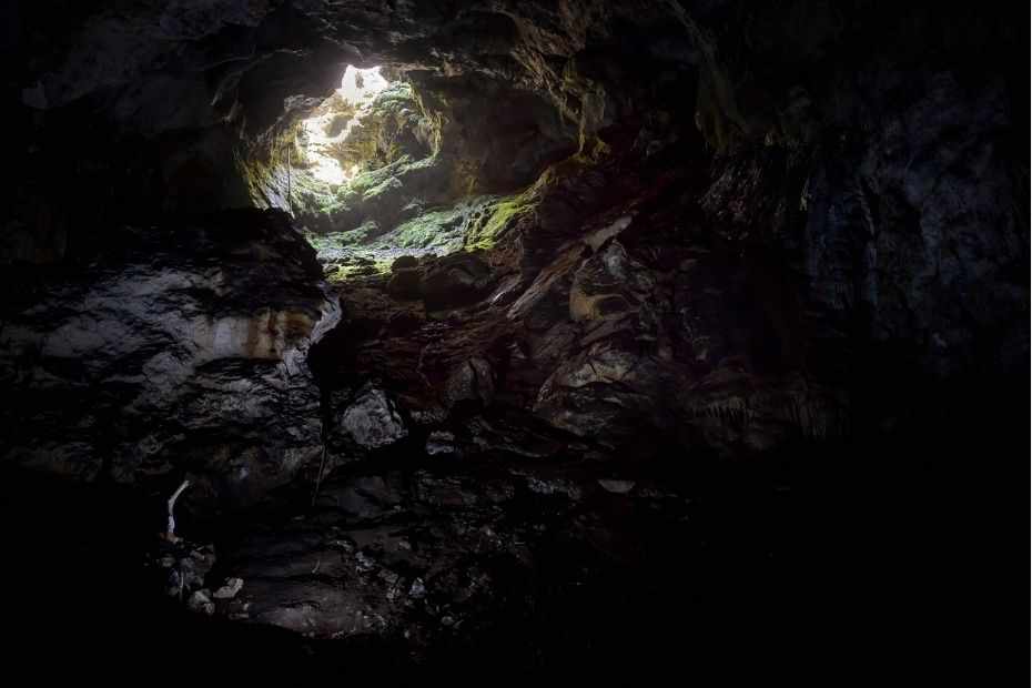
Karst caves are shaped by chemical weathering of the bedrock. These formations are commonly found in limestone areas. Karst Caves are voids in the rock that form naturally when water erodes away limestone or other soluble rocks. These voids sometimes connect to the surface of the land when they open up to small openings in the ground.
The most famous Karst Caves are in Slovenia in Europe which is home to about 10% of the world’s total.
#2. Cenote
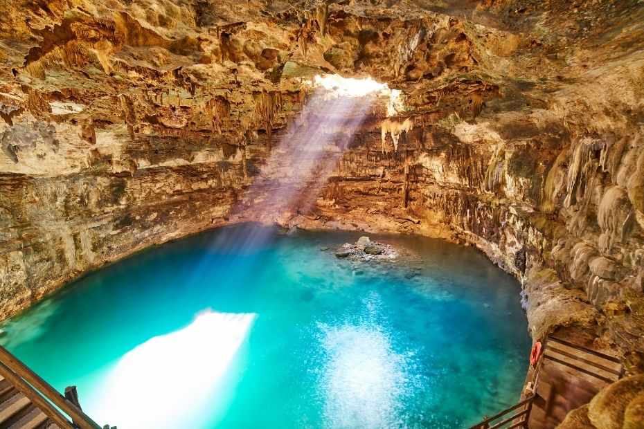
A cenote is a natural pit, or sinkhole, resulting from the collapse of limestone bedrock that exposes groundwater underneath. A cenote may also refer to the deep water that fills the pit. A surface stream draining into a cenote can cause it to appear as if it were flowing uphill, because of the natural force of gravity pulling on the water.
Some examples of notable cenotes are: The Yucatán Peninsula in Mexico.
#3. Foiba
The Foiba is comprised of several underground chasms, some of which are connected by surface streams. The sinkholes form as water erodes the soft limestone rock underneath it.
It is not certain whether the name has any connection to the word “foibe”, which in some countries denotes a type of sinkhole.
#4. Scowle
Scowles are landforms of karst and can vary in size and form. They can be found in the Forest of Dean for example, as well as providing a home to many species of wildlife.
#5. Turlough
Turloughs are found west of the River Shannon in Ireland and are karst features that only exist in Ireland because of its unique limestone landscape. They are disappearing lakes found within this limestone area.
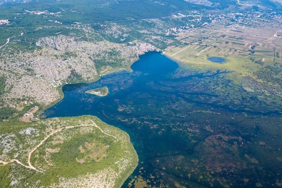
#6. Uvala
Uvalas are geological depressions that result from rapid erosion happening along tectonic plates. They tend to be elongated and irregular in shape.
Uvala landforms have been seen in parts of Croatia, Montenegro, and Serbia as well as other areas.
#7. Limestone Pavement
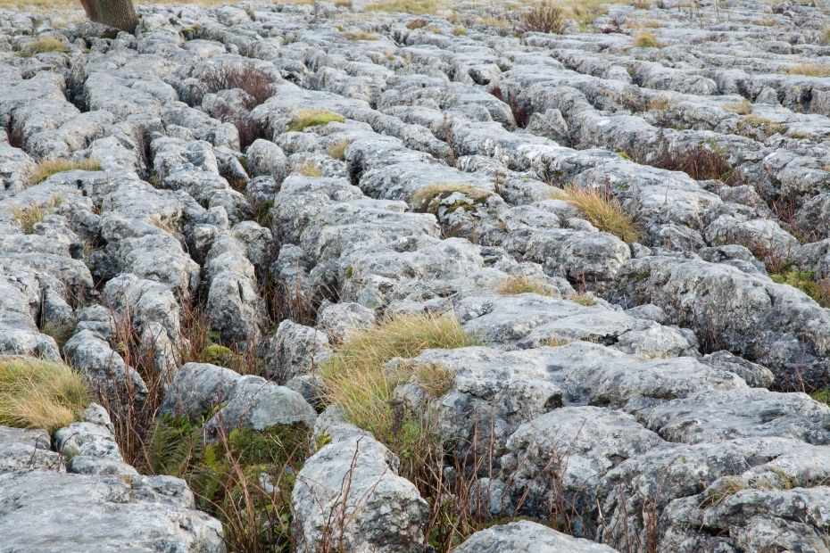
Karst terrain is primarily found in Ireland and the UK. It looks like a man-made pavement and is known as such. Karst terrain is primarily made up of limestone which has been split by rainwater runoff and it’s flat, incised and exposed. The similarities between this landscape and an artificial pavement can be seen as a result of shallow caves that form below ground.
#8. Polje
Polje are steep-sided, flat-floored valleys that are found in karst regions globally. Several sinkholes coalesce together to form a Polje. Poljes are characterized by their area varying between 5 to 400 square kilometers.
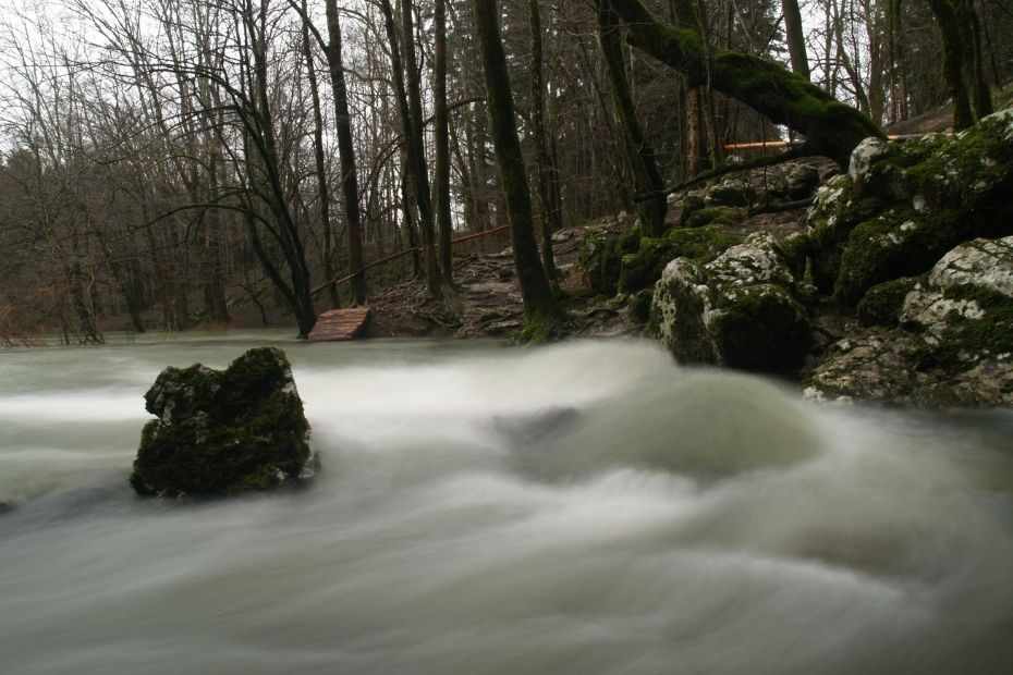
#9. Karst Spring
A Karst Spring is a popular type of water spring, usually located in a karst area and with a high discharge. As it drains the underground water of the area, the shape of these springs is usually bowl- or cylindrical shaped.
Papua New Guinea is one of the only places in the world where large karst springs exist.
#10. Ponor
A ponor is also a natural opening in a karst landscape. a ponor is more like a portal for the entry of surface water to the underground. Lakes and streams disappear when ponors are reached.
#11. Sinking River
A sinking river is a type of river that gradually becomes shallower as it flows downstream. This typically happens because the water seeps into the ground and increases the groundwater levels.
#12. Karst Fenster
Karst fensters are a type of interesting feature which is found in karstic areas. They involve the flow of underground water that intermittently disappears into a sinkhole.
#13. Calanque
A calanque is a type of limestone coastline, which is formed by either the collapse of the roof of a cave or by fluvial erosion.
#14. Mogote
Mogote are a type of hill made up of limestone, dolomite or marble. They often have a rounded shape and steep sides.
#15. Abîme
Vertical shafts in a karst landscape can be referred to as an abîme. The landform is usually deep and connects to a massive subterranean network of passages. Abîmes can have a diameter from 1 meter up to 10 meters and be up to 50 meters deep.
Conclusion: What Is Karst Topography
Karst topography is a landscape that is characterized by the dissolution of rocks by acidic groundwater. It is often densely forested and has steep slopes. This process often leads to the formation of sinkholes and underground streams. Karst landscapes cover some 20% of Earth’s surface area and contain about 80% of its known caves.
To fully understand the formation of Karst topography, it is important to understand the geological processes that led to its formation. Karst topography primarily occurs in humid, tropical regions with limestones or chalks that are chemically soluble in acidic water.