Are you frustrated with the inaccuracies in traditional land surveying methods? These errors can cause significant delays and costly mistakes. The application of GPS in land surveying offers a revolutionary solution – achieving precise measurements and boosting efficiency, enabling you to bypass the challenges of conventional surveying and stride confidently into a future of unprecedented accuracy.
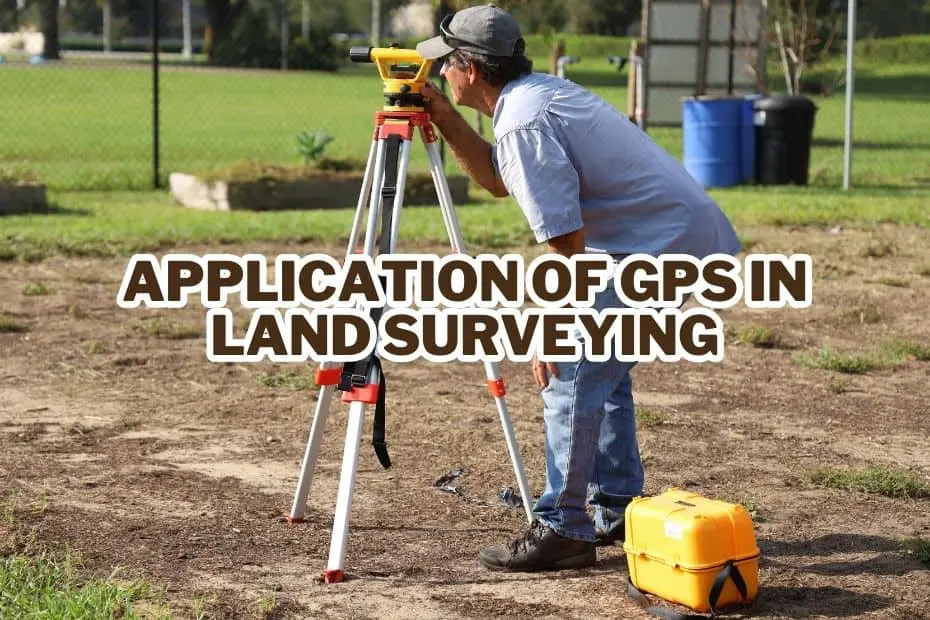
GPS (Global Positioning System) is widely used in land surveying due to its accuracy and efficiency. It allows surveyors to determine precise locations and collect data for mapping, boundary establishment, and construction projects.
GPS technology enables real-time positioning, reducing fieldwork time and improving the overall accuracy of survey measurements. It has revolutionized the field of land surveying by providing an effective tool for geospatial data collection and analysis.
Application of GPS In Land Surveying
Land surveying, a field marked by precision and detail, has dramatically benefited from the integration of GPS technology. Whether it’s delineating property boundaries or mapping out construction sites, GPS has become an invaluable tool for surveyors worldwide.
1. Mapping and Geographic Information System (GIS) Integration
Accurate mapping lies at the heart of land surveying, and GPS technology plays a pivotal role in this domain. By utilizing GPS receivers, surveyors can precisely determine their location on the Earth’s surface.
These receivers capture signals from multiple satellites and calculate the exact coordinates of survey points. This information is then integrated with Geographic Information System (GIS) software, enabling surveyors to create detailed maps and spatial databases.
The combination of GPS and GIS empowers land surveyors to accurately represent geographical features, land boundaries, and other critical information in a digital format, facilitating efficient decision-making in various fields.
To delve deeper into the integration of mapping and GIS, check out this informative article: Applications of GPS.
2. Boundary Determination and Cadastral Surveys
Boundary determination is a crucial aspect of land surveying, particularly in legal and property-related matters.
GPS technology provides land surveyors with a reliable and efficient means of accurately defining land boundaries. By employing GPS receivers, surveyors can establish precise coordinates for boundary markers, significantly reducing the margin of error that existed in traditional surveying methods.
This enhanced accuracy is especially valuable in cadastral surveys, where the demarcation and documentation of land ownership are essential. With GPS, surveyors can ensure the integrity of land boundaries, resolving disputes and establishing legal frameworks with confidence.
For a comprehensive understanding of the differences between GPS and Differential GPS (DGPS) in boundary determination, refer to this insightful article: Difference between GPS and DGPS.
3. Construction Surveying and Layout
Construction projects demand precise measurements and accurate layout for successful execution.
GPS technology has transformed the way construction surveying is carried out, making the process more efficient and accurate. Surveyors can utilize GPS receivers to determine the coordinates of critical construction points such as corners, reference points, and elevations.
This information aids in establishing accurate reference lines, facilitating the layout of structures and infrastructures with precision. GPS-enabled construction surveying minimizes errors, reduces rework, and streamlines the overall construction process, resulting in cost savings and timely project completion.
Curious about how GPS is used in vehicle tracking systems? This article provides valuable insights: GPS Vehicle Tracking System.
4. Topographic Surveys and Digital Terrain Modeling
Topographic surveys involve the detailed mapping of natural and man-made features on the Earth’s surface.
GPS technology has revolutionized topographic surveys by offering an efficient and accurate means of data collection. Surveyors equipped with GPS receivers can capture precise coordinates of various features such as contours, vegetation, water bodies, and infrastructure. These coordinates are then used to create detailed topographic maps and digital terrain models, providing valuable information for urban planning, environmental assessment, and engineering projects.
GPS-enabled topographic surveys enable surveyors to acquire comprehensive data in a shorter time frame, saving resources and enhancing project outcomes.
To gain a deeper understanding of the accuracy of GPS and how it impacts topographic surveys, check out this informative article: How Accurate is GPS?.
5. Control Point Establishment and Network Surveys
Control points are essential reference points used to establish the spatial framework for surveying projects.
GPS technology plays a vital role in the establishment of control points, enabling surveyors to accurately determine their coordinates. By utilizing GPS receivers, surveyors can quickly and efficiently measure control points over large areas, reducing the need for extensive ground-based measurements. These control points serve as the foundation for network surveys, where interconnected points are established to ensure accuracy and consistency across the survey area.
GPS-based control point establishment and network surveys enhance the reliability and precision of subsequent surveying activities, saving time and resources.
6. Surveying in Challenging Environments
Land surveyors often encounter challenging environments that pose difficulties in data collection. GPS technology has proven to be invaluable in such situations, offering enhanced capabilities for surveying in rugged terrains, dense vegetation, and remote areas.
Unlike traditional surveying methods that relied heavily on line-of-sight measurements, GPS enables surveyors to collect data from satellites overhead, regardless of the surrounding obstacles. This allows for more efficient data acquisition and improved accuracy, even in challenging environments.
Whether it’s surveying mountainous regions, dense forests, or isolated islands, GPS technology empowers land surveyors to overcome obstacles and obtain precise measurements.
7. Monitoring and Deformation Analysis
Monitoring the stability and deformation of structures and natural features is a critical aspect of land surveying. GPS technology provides an effective means of monitoring such changes over time.
By installing GPS receivers at specific locations, surveyors can continuously track and record the precise coordinates of monitoring points. This data can then be analyzed to assess any shifts, movements, or deformations in the monitored features. GPS-based monitoring and deformation analysis are essential in various applications, including infrastructure stability assessment, landslides monitoring, and coastal erosion studies.
The real-time and accurate data provided by GPS technology enables proactive decision-making and timely interventions to mitigate potential risks.
For a comprehensive understanding of the uses of GPS in agriculture, check out this informative article: Uses of GPS in Agriculture.
8. Hydrographic Surveys and Bathymetry
Hydrographic surveys involve the mapping and measurement of water bodies, including oceans, rivers, and lakes.
GPS technology has significantly improved hydrographic surveys by offering precise positioning capabilities for vessels and survey equipment. By integrating GPS receivers with sonar systems and echo sounders, surveyors can accurately measure water depths (bathymetry) and map the underwater topography.
This information is crucial for nautical charting, port and harbor design, marine resource management, and environmental assessment. GPS-enabled hydrographic surveys provide valuable data for navigation safety, coastal engineering, and offshore resource exploration.
9. Geodetic Surveys and Geodesy
Geodetic surveys involve the measurement and monitoring of the Earth’s shape, gravity field, and rotation.
GPS technology has revolutionized geodetic surveys by providing accurate and efficient means of data collection. By deploying a network of GPS receivers over large areas, surveyors can measure precise positions and elevations, enabling them to model the Earth’s surface and its gravitational field.
Geodetic surveys and geodesy have significant applications in geophysical research, satellite positioning, and global navigation systems. GPS technology has played a pivotal role in advancing our understanding of the Earth’s geodetic parameters and supporting various scientific endeavors.
10. Utility Infrastructure Mapping and Management
Efficient management of utility infrastructure, such as pipelines, power lines, and communication networks, relies on accurate mapping and monitoring.
GPS technology has revolutionized utility infrastructure mapping and management, providing surveyors with a powerful tool for data collection and asset tracking. By equipping utility vehicles and equipment with GPS receivers, surveyors can precisely map the location and attributes of infrastructure components. This information is invaluable for maintenance, repair, and expansion planning, as well as for identifying potential conflicts or risks.
GPS-enabled utility infrastructure mapping and management streamline operations, improve safety, and optimize resource allocation, ultimately enhancing the reliability and efficiency of utility services.
11. Environmental Monitoring and Natural Resource Management
The preservation and management of natural resources and the environment are of utmost importance in today’s world.
GPS technology plays a crucial role in environmental monitoring and natural resource management, enabling accurate data collection and analysis. By combining GPS receivers with specialized sensors, surveyors can measure environmental parameters such as air quality, water quality, and soil conditions.
These measurements provide valuable insights into ecosystem health, pollution levels, and the impact of human activities on the environment. GPS-enabled environmental monitoring facilitates evidence-based decision-making, supports conservation efforts, and helps mitigate the effects of climate change.
12. Disaster Management and Emergency Response
In times of natural disasters or emergencies, quick and accurate information is vital for effective response and recovery efforts.
GPS technology plays a significant role in disaster management and emergency response by providing real-time positioning and situational awareness. GPS-enabled devices, such as smartphones and GPS trackers, assist in locating affected areas, guiding rescue operations, and coordinating relief efforts.
Surveyors equipped with GPS receivers can rapidly assess the impact of disasters, map affected areas, and identify critical infrastructure damage. GPS technology enhances the efficiency and coordination of emergency response, contributing to saving lives and minimizing damage.
For a comprehensive understanding of the difference between GIS and GPS, refer to this informative article: Difference between GIS and GPS.
Conclusion:
In conclusion, the application of GPS in land surveying has transformed the industry, revolutionizing the way surveyors collect data, map locations, and make informed decisions. From mapping and boundary determination to construction layout and topographic surveys, GPS technology enhances accuracy, efficiency, and productivity in various surveying applications.
Moreover, GPS enables surveying in challenging environments, supports monitoring and deformation analysis, and facilitates hydrographic surveys and geodetic measurements. It plays a crucial role in utility infrastructure mapping, environmental monitoring, and disaster management.
FAQs: Application of GPS In Land Surveying
How accurate is GPS in land surveying?
The accuracy of GPS in land surveying can vary depending on several factors. With modern survey-grade receivers and proper survey techniques, GPS can achieve centimeter-level accuracy. However, factors such as signal obstruction, atmospheric conditions, and receiver limitations can affect GPS accuracy.
Can GPS replace traditional surveying techniques entirely?
While GPS technology has greatly improved surveying efficiency, it cannot entirely replace traditional surveying techniques. Traditional methods like total stations and leveling are still necessary for certain tasks that require higher precision or are not suitable for GPS, such as vertical measurements.
What factors affect GPS accuracy in land surveying?
Several factors can impact GPS accuracy in land surveying. These include satellite geometry, atmospheric conditions, signal multipath, receiver quality, and the presence of obstacles like buildings or trees. To achieve higher accuracy, surveyors must consider these factors and employ proper survey techniques.
Can GPS be used for property boundary surveys?
GPS can be used for property boundary surveys, but it typically requires additional measurements and verification to meet legal standards. While GPS can provide valuable positional data, factors like accuracy requirements, local laws, and the need to consider physical boundary markers may necessitate the use of traditional surveying techniques for property boundary surveys.
