Have you ever stopped to think about just how useful maps are in our daily lives? Maps are more than just a tool to help us find our way. They provide us with a wealth of information, from the physical landscape to the cultural and political landscape. In this article, we’ll explore 21 different uses of maps, from navigation and urban planning to environmental conservation and even art.
Maps aid in understanding spatial relationships, identifying locations, and making informed decisions.
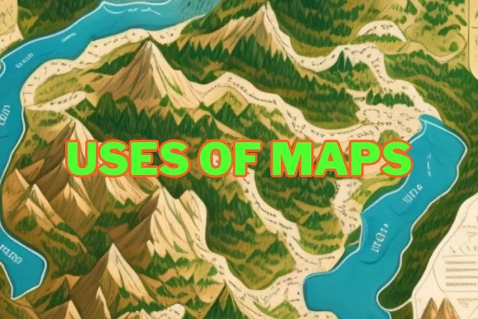
The Importance of Maps
Whether it’s for navigation, planning, education, or any of the other countless uses, maps are a crucial tool that help us understand and interact with the world. Whether you’re a student, a professional, or simply someone who loves to explore, there’s no denying the incredible impact that maps have had on our lives. Some of the uses of maps are:
1. Maps in Navigation
One of the primary uses of maps is in navigation. Maps have been used for centuries to help people find their way from one place to another. In ancient times, maps were used primarily by sailors and merchants who needed to know the location of ports, islands, and trading routes.
Today, maps are used by everyone from hikers to drivers to pilots. With the advent of GPS technology, maps have become even more important in navigation. They provide real-time information about traffic conditions, weather, and other factors that can affect travel time and safety.
2. Geographical Representation
Maps can be used to represent geographical information and provide a visual representation of the world. They can show various features such as mountains, rivers, cities, and roads, allowing us to see the relationships between different geographical features and understand how they interact with each other.
3. Maps In Exploration
Maps have also played a crucial role in exploration. From the earliest expeditions to modern space exploration, maps have been used to plan and execute journeys into uncharted territories.
One famous example of this is the Lewis and Clark Expedition of the early 19th century. The expedition, which was sent by President Thomas Jefferson to explore the newly acquired Louisiana Purchase, relied heavily on maps to navigate the unknown terrain and document their discoveries.
4. Maps In Education
Maps are also an essential tool in education. They are used to teach geography, history, and other subjects. In geography, maps are used to teach students about different countries, continents, and bodies of water. In history, maps are used to illustrate important events and show the movement of people and armies over time.
5. Maps In Business
Maps are also important in business. They are used to analyze market trends, identify potential customers, and plan marketing campaigns. For example, a business that sells outdoor equipment might use maps to identify areas where hiking, camping, and other outdoor activities are popular.
6. Planning and Decision Making
In the business world, maps are used to make informed decisions and plan for the future. For example, companies may use maps to analyze demographic data and determine the best location for a new store or office. Maps can also be used to identify potential market opportunities and assess the competition.
7. Environmental Management
Maps can be used to monitor and manage the environment. For example, maps can be used to track changes in land use, identify areas prone to natural disasters, and monitor the health of ecosystems. This information can then be used to make informed decisions about how to best protect and preserve the environment.
8. Real Estate
Maps are also an important tool for real estate, helping buyers and sellers understand the value and potential of a property. With maps, real estate professionals can see the location of a property, identify nearby amenities and attractions, and even assess the potential for future development. Whether you’re buying or selling a home, maps are a valuable tool for understanding the potential of a property.
9. Travel and Tourism
Maps are an essential tool for travel and tourism, helping individuals plan their trips and find their way around unfamiliar destinations. From city maps to hiking trail maps, maps can be used to explore new places and find the best places to visit.
10. Maps In Politics
Maps have also been used for political purposes throughout history. In ancient times, maps were used to show the extent of empires and territories. Today, maps are used in everything from election campaigns to gerrymandering.
One example of this is the use of electoral maps in the United States. These maps show the results of presidential elections by state and are used to determine the winner of the election. They can also be used to predict voting patterns and help campaigns target specific demographics.
11. Maps In Science
Maps are also important in science. They are used to visualize data and show relationships between variables. In geology, for example, maps are used to show the location of mineral deposits, fault lines, and other geological features.
In medicine, maps are used to track the spread of diseases and identify areas where outbreaks are likely to occur. This is particularly important in the case of infectious diseases such as COVID-19, where mapping the spread of the disease can help public health officials take appropriate measures to contain it.
12. Disaster Response
In the aftermath of a natural disaster, maps can be invaluable for rescue and relief efforts. Maps can show the location of shelters, hospitals, and other critical infrastructure, and they can be used to direct rescue teams to the areas that need help the most.
13. Military Operations
Maps have long been used for military purposes. Strategic planning, battlefield maps, intelligence gathering, and tactical planning are all critical components of military operations. Today, military maps are more sophisticated than ever, utilizing the latest in digital mapping technology to provide soldiers with the information they need to succeed in the field.
14. Maps In Art
Finally, maps have also been used as inspiration for artists. From ancient maps adorned with decorative illustrations to modern abstract art inspired by maps, cartography has played a role in the art world for centuries.
15. Meteorology
Meteorologists use maps to track weather patterns and predict weather conditions. Maps can show the location of high and low pressure systems, as well as temperature, precipitation, and other important weather conditions. This information can be used to make weather forecasts and warn the public about potential weather hazards.
16. Geology
Geologists use maps to study the Earth’s surface and understand the processes that shape our planet. Maps can show the location of geological features, such as mountains, valleys, and rivers, and they can be used to study the formation of these features and the processes that shape the Earth’s surface.
17. Criminology
Criminologists use maps to study crime patterns and identify areas with high levels of criminal activity. Maps can show the location of crimes, as well as the location of police stations, prisons, and other important criminal justice facilities. This information can be used to study crime patterns and develop strategies to reduce crime and improve public safety.
18. Historical Context
Maps are also a valuable tool for understanding historical events and the way they have shaped our world. From ancient maps of the known world to modern maps of historical events, maps help us understand the context of events and the way they have affected the world.
By using maps to understand history, we can gain a deeper appreciation for the events that have shaped our world and the impact they have had on our lives.
19. Natural Resource Management
Maps are also a crucial tool for natural resource management, helping organizations understand the distribution and use of resources like water, timber, and minerals. By using maps to analyze resource data, they can identify areas of high resource potential, track the impact of resource extraction, and even plan for sustainable resource use.
Whether you’re a resource manager or an environmental advocate, maps are a valuable tool for ensuring the responsible use of our natural resources.
20. Gaming
Maps are used in a variety of games, including strategy games, role-playing games, and adventure games. Maps can show the location of players, enemies, and other important features, and they can be used to plan strategies and navigate through the game world.
21. Oceanography
Maps play a crucial role in the study of oceans, helping oceanographers to understand the world’s oceans. Maps can show the location of ocean currents, tides, and other important oceanographic features, as well as the distribution of marine life.
Future of Maps
Looking to the future, it’s clear that maps will continue to play a critical role in our lives. Advancements in mapping technology, increased accessibility and usability, and integration with other technologies will all have a major impact on the way we use and experience maps. As we continue to push the boundaries of what is possible with maps, we can expect to see a continued impact on society and the world as a whole.
Conclusion: Uses of Maps
In conclusion, maps have been an essential part of human civilization for centuries. They have been used in navigation, exploration, politics, science, education, business, and even art. With the development of technology, maps have become even more important in our daily lives. Whether we are driving to work, planning a trip, or analyzing market trends, maps play a crucial role in helping us navigate the world around us.
READ MORE:
FAQs: Uses of Maps
What are the different types of maps?
There are several types of maps, including physical maps, political maps, topographical maps, road maps, and weather maps, among others. Each type of map serves a specific purpose and provides different information.
How are maps made?
Maps are made using a combination of surveying, satellite imagery, aerial photography, and other techniques. Cartographers then use this information to create accurate and detailed maps of the area in question.
How accurate are maps?
The accuracy of a map depends on several factors, including the quality of the data used, the scale of the map, and the skill of the cartographer. In general, modern maps are highly accurate, with many digital maps providing real-time data and updates.
Can maps be used for artistic purposes?
Yes, maps have been used as inspiration for artists for centuries. Cartography can be used to create unique and beautiful works of art, from antique maps with ornate illustrations to modern abstract pieces inspired by maps.
How do maps impact our daily lives?
Maps play a crucial role in our daily lives, providing us with important information and helping us navigate the world around us. They are used in a variety of industries, from transportation and real estate to tourism and urban planning.
