
A coordinate system defines the location of a point on a planner or spherical surface. Without a precise definition of coordination system to be used to represent a point, it is difficult to change into a new coordinate system. It is necessary to change the coordination system when integrating data from different sources into a normal coordination system. There are many Coordinate System Used In GIS to represent the Earth Surface.
A geographic coordinate system is a three-dimensional reference system that detects points on the surface of the Earth. The unit of measurement is usually a decimal degree. There are two coordinate values in one point: latitude and longitude. Angle of latitude and longitude measurements
Latitude is defined as an angle formed by an intersection on the vertical line of the surface of the earth on a plane and on the plane of the equator. There are positive latitude values in the north of the equator, whereas in the south, the numbers are negative values. Latitude values are from -90 to +90 degrees. The lines of latitude are called parallel because a special value of latitude forms a parallel circle to the equator.
A meridian, or line of the longitude, is formed by a plane which passes through the point and north and south poles. The longitude value is defined by an angle between the plane and the reference plane. This is known as the prime meridian. The most used prime meridian passes through Greenwich, United Kingdom. Other alternative prime meridians in use pass through Paris and Bogota. The longitude value is range from -180 to +180 degrees.
Types of Coordinate System
The following are two common types of Coordinate system used in GIS (Geographic Information Systems):
Latitude-longitude such as global or spherical coordinate systems. These are often known as geographical coordinate systems.
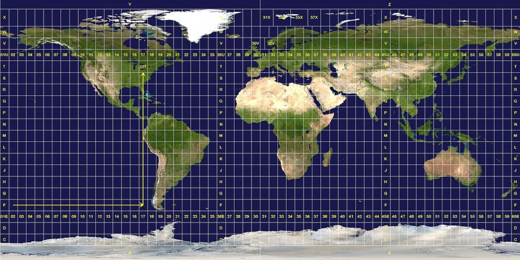
An projected coordinate system such as universal Transverse Mercator (UTM), Albers Equal Area, or Robinson, all of which provide various mechanisms on two-dimensional Cartesian coordinate to project maps of the Earth’s spherical surface (with several other map projection models). Projected coordinate system is known as map projections.
Coordinating systems (both geographical and projected) provide a framework to define real world locations.
What Is A Spatial Reference?
A spatial reference is georeferencing and coordinate system that is assigned to any geographic data, including raster datasets and raster catalogs. The spatial reference defines how the geographic data changes mathematically to a flat map with minimal deformation. There will always be some type of distortion in the geographic data because you are trying to project three-dimensional data on a three-dimensional plane. When you choose a spatial reference, you have to choose which type of distortion you want to reduce.
Many predetermined spatial references are already defined and available for use. If any of these spatial references do not represent the desired projection, then you are able to modify the current estimates or create your own. If you want to use the same local reference as an existing feature class, feature dataset or dataset, you can also import that exact spatial reference.
Converting one projection to another can change the size and area of a cell on the surface of the earth. Each projection treats the relationships between a three-dimensional world and a two-dimensional one. You must be aware of properties and perceptions for each projection before you choose.
Read More: Map Projection in GIS
What are the projected coordinate systems?
An approximate coordinate system is defined on a flat, 2-dimensional surface. Contrary to a geographical coordinate system, in projected coordinate system, two dimensions consist of continuous length, angle and area. A projected coordinate system is always based on the geographic coordinate system, which is based on circular or spherical.
In an projected coordinate system, places are identified by the coordinates x and y on the grid, with the origin in the center of the grid. In each case there are two values that refer to it at that central location. One specifies its horizontal position and the second its vertical position. Two values are called X-coordinate and Y-coordinate. Using this notation, the coordinate on the original are x = 0 and y = 0.
What are geographical coordinate systems?
A geographic coordinate system (GCS) uses a three-dimensional spherical surface to define locations on Earth. A GCS is often incorrectly called datum, but a datum is only part of GCS. A GCS includes an angular unit of measurement, a major meridian, and a datam (based on spherical).
A point is referred to by its longitude and latitude values. Longitude and latitude are the measured angles up to a point on the surface of the Earth from the center of the Earth. Angle is often measured in degrees (or in grads).
In the spherical system, horizontal lines, or east-west lines, are similar latitude or parallel lines. Vertical lines, or north-south lines, are lines of equal longitude or meridian. These lines incorporate the world and make a grid network called a graticule.
Between the poles, the line of the latitude midway is called the equator. It defines the line of zero latitudes. The line of zero line is called the main meridian. For most geographic coordinate systems, Prime Meridian is the longitude that goes through Greenwich, England. Other countries use longitude lines passing through Bern, Bogota and Paris. The origin of the Graticule (0, 0) is defined where the equator and main meridian differ. Then the world is divided into four geographic quadrilaterals which are based on the compass bearings originally. North and South Equatorial are above and below, and west and east prime meridians are left and right.
Latitude and Longitude values are traditionally measured in decimal degrees or degrees, minutes, and seconds (DMS). The latitude value is measured between the equators at range from -90 at the South Pole to +90 at the North Pole on the equatorial pole from the equator. The longitude value is measured relative to the prime meridian. While traveling in the east, they are up to -180 ° while traveling 180°. If prime meridian is in Greenwich, then Australia, which is east of the equator and east of Greenwich, has positive longitude value and negative latitude value.
As you know, Both Geographical and Projected Coordinate system used in GIS to represent the Earth Surface to an flat surface or on Paper. If you like this article and found it useful, then please share this on social media.
